If you have that pond/property picked out. I've been told that you can google earth and locate the pond and then go back through it's history of pictures of the pond. Giving you an idea on how the pond has looked over the past 10 yrs. We have had a bad drought a few yrs back here in Texas and maybe it might show what the pond looked like during that time.
Do not judge me by the politicians in my City, State or Federal Government.
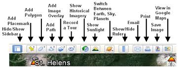
As far as I know, Google Earth Pro is the only version that gives you the history of a location. To use it, just type in the address you're wanting data about in the top left search box, and then zoom in on that location in the mapping part itself. Then go to the top left menu bar and click on the counterclockwise clock just to the left of the sunrise button, and then the history bar shows up just below the menu bar. Is that confusing? Kinda hard to explain without actually seeing it.
Really not trying to hi jack the tread. Can you screen shot the clock n sunrise button your talking about. I'm not finding anything like this. I might have to be on work computer. Sometimes desktop versions are different.
I have someone who has a PC looking into it. You can only get that pro version as stated, on a PC. The pond that I'm looking into is larged size with several Springs. It'll be interesting to see the pictures when he sends them to me.
U S, they do have a Mac app, but as with most things with PCvsMAC, the menus are different so I didn't want to post a Mac version pic. I use it on mine.
As was stated earlier, springs don't have a one way valve on them, what they give they can also take away.
I actually consider a "spring fed pond" a groundwater pond unless there is actually an artesian spring feeding the pond, or a spring that flows into the pond from above the high water line in the pond. Groundwater ponds fluctuate according to groundwater levels, or water that has not percolated down into the groundwater yet. i.e. a pond that is dug 10' deep in sandy soil, and it has a 12" layer of clay at 12' depth. Snowmelt or rain completely saturates that top 12 feet of soil, and the water seeps into the pond. As the water seeps through that clay layer, or vegetation uses that water, the water in the pond will slowly recede.
If I had a choice between a pond that was sealed and had to rely on watershed flow or a well to keep the pond full vs. a water table or spring fed pond, I'd pick the sealed pond.
The upside to a ground water pond is that when the water recedes from the pond, nutrients in the water are also leached out, so that helps (or hinders) depending on the specific pond.