First is a Google Earth image that shows the entire 68 acres. It is comprised of three separate tracts of land.
The top right rectangle is the 50 acre tree farm, but will also contain the majority of the larger fishing pond.
The bottom rectangle is a 14 acre tract that contains old growth forest and pasture, and contains the entire, smaller watershed-catching pond, which I call the settling pond. Our homesite is also on this tract.
The left rectangle is a 4 acre tract that we bought just to provide a driveway to the farm to market road. It is about half old growth forest and half pasture.
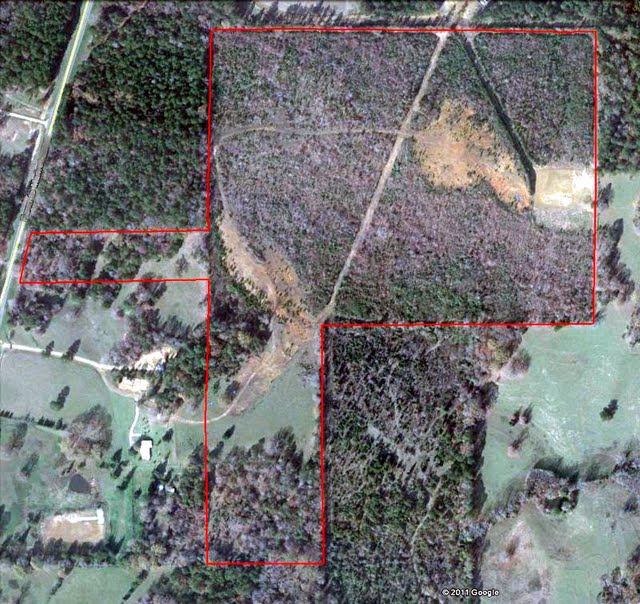
As you can see, there is a gas well and two pipeline right-of-ways on the 50 acre plot. The two reddish looking areas are where iron ore was dug and crushed to make gravel by a previous owner years ago. There is still literally tons of iron ore on the property, from pea gravel size to boulders that probably weigh over a ton. And there are places where the ground looks like it is solid rock for several square feet. When it comes to rock, I have a plentiful resource.


