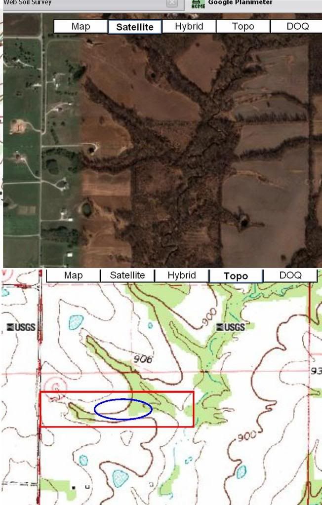
I assume that your topo is 10' elevation for every graduated line. You would have to dig so far down to keep the water off your neighbor that you might be flirting with the creek level.
For the sake of accuracy, I pulled up the USGS topo map, and I placed satellite image above it. Red square represents approx property lines, blue oval represents approximate pond site. I don't know that much about reading these things, so I hope this makes it easier for you to accurately interpret the terrain and such.
Mac