Hey Bski, since the 24'x48' under discussion is the vacation home destined to become a guest cottage/workshop and not the eventual B/Dski retirement castle, do you have the location for the latter picked out as well?
...since you ask
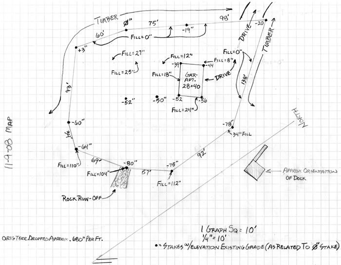
This is a site map of the building area. The points along the bottom of the map are set at the crest along the pond shoreline (and slopes down into the pond beyond them). It also shows the elevation changes of the current/existing grade. I included the estimated depth of the fill used to get to these current/existing levels.
**NOTE** the plan shows the structure footprint at the old dimension of 40' deep; it is now at 44'
--