Bill,
I hope you're right. I don't think the seepage point in the pond and the groundwater/spring I have piped in are one and the same.
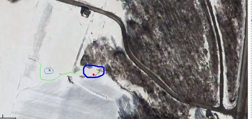
The image below is pretty crude, based on Google earth winter satellite image, but shows the location of the original hand dug well (small blue circle), the grounwater supply installed (green line), the pond perimeter (heavy blue line) and the approximate location of the spring (red dot).
The hand dug well to the West was about 10 feet in elevation higher than what I hope the full water elevation of the pond will be. The area immediately to the south of the pond is a pretty steep hillside, probably 2:1 slope rising about 75 feet. I have no way of knowing where this spring seepage in the pond basin is coming from though. Probably from the higher elevation somewhere....