|
Forums36
Topics41,086
Posts559,397
Members18,578
| |
Most Online3,612
Jan 10th, 2023
|
|
|
13 members (FishinRod, Bill Cody, Fishingadventure, Jason D, Sunil, LANGSTER, Commander, LeighAnn, Boondoggle, Quarter Acre, Augie, jludwig, wlykins),
1,077
guests, and
337
robots. |
|
Key:
Admin,
Global Mod,
Mod
|
|
|
|
Joined: Sep 2004
Posts: 84
Member
|
OP

Member
Joined: Sep 2004
Posts: 84 |
As the possible date for ground breaking nears, I have found my stress level pegging 11. I feel like I am at a serious cross roads and the wrong decision could be very bad. The county I live in is famous for clay. Clay, clay, clay! My well log shows clay from 1.5' down to 120'(well head is about 150' from pond site). I suppose I just assumed perfectly good soil conditions. While exploring some soil maps, I discovered that my place is "birch bay silt". So I did what any self respecting adult with OCD would do, I grabbed my shovel and proceeded to try and dig to china for a soil sample. I dug at a point that is closest to the creek (150') and the site of the dam foundation. I dug down about 3' and hit what looked like "blue clay". It was blue, would compact into a nice ball, but had a very gritty feeling to it. Not the smooth, slippery, texture I expected. I then screened it through a 1/4" mesh, per pub 590, and did the mason jar test. The "sand" settled out immediately to about 35% of the column. Then a silky brown layer of what I am assuming is "silt" formed the next 60%. The water was then left with a light cream color to it, with a light cream scum forming on the top layer. Is this my clay content? I realize that I am only 3' down, but it makes a guy wonder. So now I am going to move up the test pit date before I do anything else. ARRRGGGGHHHHH!!!!!  Joe
|
|
|
|
|
Joined: Aug 2002
Posts: 20,043 Likes: 1
Hall of Fame  Lunker
|
Hall of Fame Lunker
Joined: Aug 2002
Posts: 20,043 Likes: 1 |
Don't panic yet Joe. You may have better clay deeper. Some of those maps are not 100 percent accurate. You could have pockets of soil like that etc. and not the entire area. This could be remedied by moving good clay where it is needed. I wouldn't hasten judgement until you get your test dig made.
If it makes you feel any better I was discouraged to build my first pond based on the test dig. It was great clay down to 13 feet and then it was sandbox sand and then large gravel. The most beautiful sand and gravel you had ever seen! Great for a gravel pit but horrible for a pond. However I had the excavator go down only 11 feet and pack a layer of clay and this pond has not given me a lick of trouble since the 9 years it's been there. In fact it has performed better than the other three ponds on the property.
If pigs could fly bacon would be harder to come by and there would be a lot of damaged trees.
|
|
|
|
|
Joined: Jun 2005
Posts: 2,365
Lunker
|
|
Lunker
Joined: Jun 2005
Posts: 2,365 |
Great post Joe. I can feel your anxiety! Relax, it always feels better when it quits hurting.  The soil near the creek bed may not representative of what you you will find deeper. Of course there is always a chance of hitting an old, meandering creek bed at different depths, but I wouldn't worry about it. Sand or gravel deposits probably won't be thick in such a widespread clay area as yours. As much clay as you have, you won't have any problems keying your dam or packing in any sandy areas you happen to uncover. Good luck, and keep us informed!
|
|
|
|
|
Joined: Sep 2004
Posts: 84
Member
|
|
OP
Member
Joined: Sep 2004
Posts: 84 |
Thanks for the cheer up. Here is a description of the soil from the soil map.
LOCATION BIRCHBAY WA
Established Series
IRD - AG/RJE
10/2002
BIRCHBAY SERIES
The Birchbay series consists of deep, moderately well drained soils formed in volcanic ash and loess over glaciofluvial deposits and glaciomarine drift. Birchbay soils are on wave-reworked glaciomarine drift plains. Slopes are 0 to 15 percent. The average annual precipitation is 30 to 40 inches and the mean annual air temperature is about 50 degrees F.
TAXONOMIC CLASS: Coarse-loamy over sandy or sandy-skeletal, isotic over mixed, mesic Typic Haplorthods
TYPICAL PEDON: Birchbay silt loam - on a 1 percent north-facing slope in pasture at 220 feet elevation. (Colors are for moist soil unless otherwise noted. All textures are apparent field textures.)
Ap--0 to 8 inches; dark brown (10YR 3/3) silt loam, dark yellowish brown (10YR 4/4) dry; moderate medium granular structure; soft, very friable, nonsticky, nonplastic, weakly smeary; many very fine and fine roots; many very fine irregular pores; 2 percent pebbles; NaF pH 9.8; slightly acid (pH 6.2); abrupt smooth boundary. (4 to 10 inches thick)
Bs1--8 to 12 inches; dark brown (7.5YR 4/4) silt loam, strong brown (7.5YR 5/6) dry; weak fine subangular blocky structure; soft, very friable, nonsticky, nonplastic, weakly smeary; common very fine and fine roots; many very fine irregular pores; 10 percent pebbles; NaF pH 10.5; medium acid (pH 5.8); clear smooth boundary.
Bs2--12 to 24 inches; dark yellowish brown (10YR 4/4) gravelly silt loam, brownish yellow (10YR 6/6) dry; weak medium subangular blocky structure; soft, very friable, nonsticky, nonplastic, weakly smeary; common very fine and fine roots; many very fine irregular pores; 20 percent pebbles: NaF pH 11.0; medium acid (pH 5.8); clear smooth boundary. (Combined thickness of the Bw horizon is 8 to 24 inches)
2C1--24 to 42 inches; dark yellowish brown (10YR 4/4) very gravelly sand, brownish yellow (10YR 6/6) dry; massive; slightly hard, very friable, nonsticky, nonplastic; very few fine roots; many fine irregular pores; 35 percent pebbles and 5 percent cobbles; NaF pH 11.0; medium acid (pH 5.6); clear wavy boundary. (8 to 22 inches thick)
3C2--42 to 60 inches; pale yellow (2.5Y 5/4) loam, light olive brown (2.5Y more than/4) dry; many large prominent mottles of strong brown (7.5YR 5/6), reddish yellow (7.5YR 6/6) dry; massive; very hard, firm, slightly sticky, slightly plastic; few fine irregular pores; 10 percent pebbles; medium acid (pH 5.8).
TYPE LOCATION: Whatcom County, Washington; about 5 miles west of Ferndale; 2,400 feet south and 1,600 feet east of the northwest corner of sec. 16, T. 39 N., R. 1 E.
RANGE IN CHARACTERISTICS: Mean annual soil temperature is 50 to 54 degrees F. These soils are usually moist, but are dry for 60 to 75 consecutive days following the summer solstice. Thickness of volcanic ash influence and depth to the 2C horizon is 14 to 32 inches. Depth to the 3C horizon is 40 to 60 inches. By weighted average, the upper part of the particle-size control section has 5 to 25 percent pebbles, and the lower part has 35 to 50 percent pebbles and 0 to 5 percent cobbles. Reaction is medium acid or slightly acid throughout.
The A horizon has hue of 7.5YR or 10YR, value of 2 through 4 moist, 4 or 5 dry, and chroma of 2 through 4 moist, 3 or 4 dry. Some pedons have an E horizon
The Bs horizon has hue of 7.5YR or 10YR, value of 3 or 4 moist, 5 or 6 dry, and chroma of 4 through 6 moist and dry. It is silt loam, loam, gravelly silt loam, or gravelly loam.
The 2C horizon has hue of 10YR or 2.5Y, value of 3 through 5 moist, 5 or 6 dry, and chroma of 2 through 4 moist, 2 through 6 dry. It is very gravelly loamy sand or very gravelly sand.
The 3C horizon has hue of 10YR through 5Y, value of 4 through 6 moist, 5 through 7 dry, and chroma of 2 through 4 moist and dry. Rock fragments average from 5 to 25 percent, although subhorizons contain up to 35 percent. It is loam, gravelly loam, clay loam, gravelly clay loam, or silty clay loam. Thin strata of sandy loam are in some pedons.
COMPETING SERIES: These are the Lystair and Winston series in the same family. Lystair soils are less than 15 percent rock fragments throughout the particle-size control section. Winston soils are dry for 45 to 60 consecutive days and are more than 35 percent rock fragments in the lower part of the particle-size control section.
GEOGRAPHIC SETTING: Birchbay soils are wave-reworked glaciomarine drift plains at elevations of 50 to 350 feet. The soils formed in volcanic ash and loess over glaciofluvial deposits and glaciomarine drift. Birchbay soils are in a marine climate with warm, dry summers and cool, moist winters. Snow cover is intermittent. Average annual precipitation is 30 to 40 inches, which falls mostly between October and May. Each of the summer months has at least one inch of rainfall. Mean January temperature is 36 degrees F; mean July temperature is 62 degrees F. The mean annual temperature is 50 degrees F. The frost-free season is 160 to 200 days.
GEOGRAPHICALLY ASSOCIATED SOILS: These are the Clipper, Hale, Kickerville, Labounty, Tromp, Whatcom, and Whitehorn soils. Clipper and Hale soils have mottles with a chroma of 2 or less within 15 cm below the spodic horizon. Hale soils have less than 35 percent rock fragments in the lower part of the control section. Kickerville soils are loamy-skeletal and well drained. Labounty and Whitehorn soils have an aquic moisture regime. In addition, Labounty soils are fine-loamy and Whitehorn soils are coarse-loamy. Tromp soils have grayish mottles within 30 inches of the surface and have less than 35 percent fock fragments in the lower part of the particle-size control section. Whatcom soils are fine-loamy.
DRAINAGE AND PERMEABILITY: Moderately well drained; very slow to medium runoff; moderate permeability in the solum, very rapid through the sandy upper substratum, and slow through the loamy lower substratum. A perched water table is at 2 to 4 feet from December through April.
USE AND VEGETATION: Used mainly for woodland and hay and pasture. It is also used for homesites and cropland. Native vegetation is Douglas-fir, red alder, western hemlock, western redcedar, grand fir, and paper birch, with an understory of vine maple, red huckleberry, salal, western swordfern, and Oregon-grape.
DISTRIBUTION AND EXTENT: Puget lowlands in northwestern Washington. The series is of small extent.
MLRA OFFICE RESPONSIBLE: Portland, Oregon
SERIES ESTABLISHED: Whatcom County, Washington, 1983.
REMARKS: This draft reflects a change in classification from medial over sandy or sandy-skeletal, mixed, mesic Andic Xerochrepts to coarse-loamy over sandy or sandy-skeletal, mixed, mesic Typic Haplorthods. Diagnostic horizons and features recognized in this pedon are an ochric epipedon from the surface to 8 inches, a spodic horizon from 8 to 24 inches, and a lithologic change to sandy-skeletal material at 24 inches. The spodic horizon does not meet chemical criteria for a spodic horizon, but does have micro morphological criteria, i.e. cracked coatings and silt-sized and larger pellets.
--------------------------------------------------------------------------------
National Cooperative Soil Survey
U.S.A.
Doesn't look good.
|
|
|
|
|
Joined: Sep 2004
Posts: 84
Member
|
|
OP
Member
Joined: Sep 2004
Posts: 84 |
A bit of an update. I pulled well logs for everyone around me and they look a lot more promising than the soil maps. With a few gravel exceptions, looks like there should be plenty of clay down there, some where, over there, hopefully.
Joe
|
|
|
|
|
Joined: May 2004
Posts: 14,042 Likes: 301
Moderator Lunker
|
|
Moderator Lunker
Joined: May 2004
Posts: 14,042 Likes: 301 |
Cussed thread!  I've had Barry McGuire running through my head all day long.! 
"Live like you'll die tomorrow, but manage your grass like you'll live forever." -S. M. Stirling ![[Linked Image from i.pinimg.com]](https://i.pinimg.com/736x/ed/b5/e7/edb5e7f935843b996cf52be593c9ebd2--smoothie-smooth-collie.jpg)
|
|
|
|
|
Joined: Sep 2004
Posts: 84
Member
|
|
OP
Member
Joined: Sep 2004
Posts: 84 |
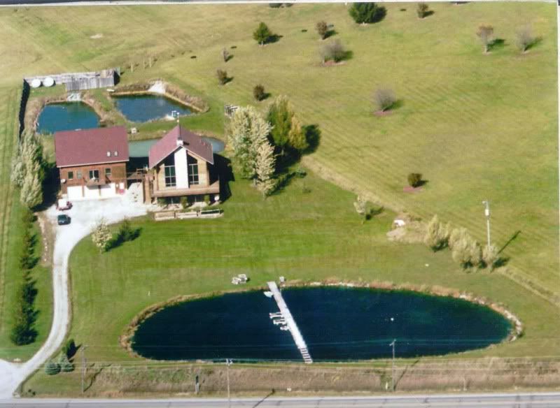
Just for you Theo...  
|
|
|
|
|
Joined: Dec 2004
Posts: 5,713 Likes: 35
Administrator Lunker
|
|
Administrator Lunker
Joined: Dec 2004
Posts: 5,713 Likes: 35 |
Hey Joe - where you goin' with that gun in your hand? Theo - Still coagulatin' 
|
|
|
|
|
Joined: Feb 2005
Posts: 4,025 Likes: 1
Lunker
|
|
Lunker
Joined: Feb 2005
Posts: 4,025 Likes: 1 |
Like me, he's hardly changed a bit in 40 yrs. :rolleyes: Better than Eddie VH after only 15 yr. or so.
|
|
|
|
|
Joined: Apr 2006
Posts: 3,261
Ambassador Lunker
|
|
Ambassador Lunker
Joined: Apr 2006
Posts: 3,261 |
joe, the 3C horizon looks really promising. you can have really tight sandy clays, or even gravelly clays that will hold water great. i would stay optimistic, re-read cecil's post.
GSF are people too!  
|
|
|
Moderated by Bill Cody, Bruce Condello, catmandoo, Chris Steelman, Dave Davidson1, esshup, ewest, FireIsHot, Omaha, Sunil, teehjaeh57
|
|
|
|
|
|
|
|
|
|
|
|
|
|
|
|
|
|
|
|
Algae
by Boondoggle - 06/14/24 10:07 PM
|
|
|
|
|
|