|
Forums36
Topics40,963
Posts557,991
Members18,503
| |
Most Online3,612
Jan 10th, 2023
|
|
|
|
Joined: Oct 2005
Posts: 6,934 Likes: 2
Ambassador
Field Correspondent Lunker
|
OP

Ambassador
Field Correspondent Lunker
Joined: Oct 2005
Posts: 6,934 Likes: 2 |
Bob Lusk just made a forum entry in his blog about mapping a body of water. He mentions 40,000 waypoints and offers a few pics. I'm asking one of 2 responses to this thread... - This is a very interesting process. I would love to know the details of execution and the equipment used. Can we discuss it on this thread?
- ...or...can we put it off for a PB magazine article?
|
|
|
|
|
Joined: Apr 2002
Posts: 904 Likes: 12
Lunker
|
|
Lunker
Joined: Apr 2002
Posts: 904 Likes: 12 |
I believe Bob hired Trent with Pond Medics out of DFW area map this lake. Trent is a Cabelas lake mapping partner, and an advertiser in the magazine. Maybe Trent will chime in on the details of this project. I recently signed on with Cabelas lake mapping as well. See http://www.cabelas.com/lake-mapping-services.shtml
Last edited by overtonfisheries; 01/18/09 02:22 PM.
It's ALL about the fish!
|
|
|
|
|
Joined: Feb 2003
Posts: 95
Lunker
|
|
Lunker
Joined: Feb 2003
Posts: 95 |
Todd - thanks for making me aware of the new topic. Brettski, I think Bob is going to be writing an article about this subject in the upcoming issues, but not sure an exact time. In the meantime, if you're interested in learning more about the mapping service and how you might be able to utilize it yourself, contact the Cabela's Lake Mapping Partner in your area and they'd be happy to discuss what the mapping can do for you and your lake.
|
|
|
|
|
Joined: May 2002
Posts: 3,973
Ambassador
Field Correspondent Lunker
|
|
Ambassador
Field Correspondent Lunker
Joined: May 2002
Posts: 3,973 |
ski, yes article coming, but quickly we (cabelas partners) use a simple system. Cabelas processes the data we simply drive around the lake and collect the data. You have to cover the shorleine closely to get enough data to show dropoff and also hit home with any other depth changes, humps, creek channels etc. Basically make a grid pattern over the lake. The data is collected with x,y on 1 sec intervals. We use a trimble geo xh unit and a depth finder. Every sec shows location of corresponding depth. Difficult to do this in less than 1.8 feet so those areas have manual depth inputs. The maps are in contour line or 3D or swim through technology. Pretty cool process. I believe Nate would be your man in your neck of the woods.
|
|
|
|
|
Joined: Oct 2005
Posts: 6,934 Likes: 2
Ambassador
Field Correspondent Lunker
|
|
OP
Ambassador
Field Correspondent Lunker
Joined: Oct 2005
Posts: 6,934 Likes: 2 |
Thanks guys.
Personally, I mapped my pond with a laser level, rod, and pencil/paper on a clipboard when the pond was still dry. Good enough for me.
|
|
|
|
|
Joined: Jul 2006
Posts: 7,615 Likes: 5
Ambassador
Field Correspondent Lunker
|
|
Ambassador
Field Correspondent Lunker
Joined: Jul 2006
Posts: 7,615 Likes: 5 |
I believe that Nate is a Cabella's pond mapping guy as well. Prior to that he use more primitive methods. 
JHAP
~~~~~~~~~~
"My mind is a raging torrent, flooded with rivulets of thought cascading into a waterfall of creative alternatives."
...Hedley Lamarr (that's Hedley not Hedy)
|
|
|
|
|
Joined: Apr 2006
Posts: 2,505
Ambassador Field Correspondent Hall of Fame  Lunker
|
Ambassador Field Correspondent Hall of Fame Lunker
Joined: Apr 2006
Posts: 2,505 |
Technology is moving at an impossible pace to keep up with!
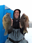
Thanks for the pic JHAP, makes me really miss summer!
|
|
|
Moderated by Bill Cody, Bruce Condello, catmandoo, Chris Steelman, Dave Davidson1, esshup, ewest, FireIsHot, Omaha, Sunil, teehjaeh57
|
There are no members with birthdays on this day. |
|
|
|