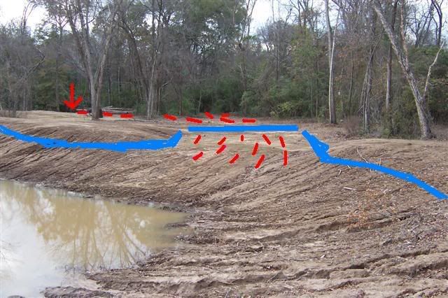
The blue line gives an idea of where the water will be when full. The red lines show the path the water will take when over flowing down to the creek. The arrow shows the location of the creek.
It's very level for over two hundred feet, then it drops off into the creek. Originally, the land was lower before the creek and the water traveled for more than a thousand feet to the place it entered the creek. This is one reason I chose this location, because of the natural bowl shape of the land. There was a four foot difference from the creeks edge to the middle of the lake.
I smoothed and shaped the spillway area to make it as flat as I could to carry the water away from teh lake with very little speed. No speed means less erosion. Or at least, that's my plan.
Eddie