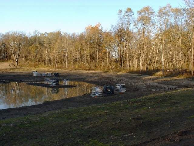
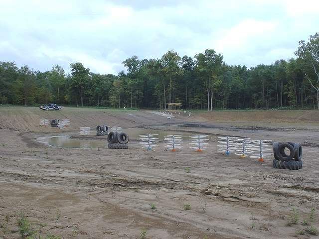
Thanks to all for kickin' this next major step around for me. I don't mind being subject for an experiment...but...I would like to go into it knowing that the variables are well known and reasonably controlled to render the most likely conclusion anticipated. I feel good so far. So, as this stocking plan gets boiled down, allow me to summarize where I (we) are right now. - It appears that YP and SMB are the fish combo of choice. Do I understand that RES should also be included? - Let's preclude BG (for now) - How about CC? Would they provide any pros or cons? No, I don't have a need or specific desire for them. The subject just never got much attention. - If I expect to see any appreciable SMB reproduction, I need to prop up my severe lack of rock. I need specific instruction as to what type, size, shape, and depth location of rock to apply. I am pretty limited on what I can do at this point. Here's the picture. There is only one area left that I can access that hasn't seen water arrival. It is a fairly large area, maybe an acre or so. It is the zone that is part and parcel of my wetland area. Now, a little more on the wetland area. Donna-ski and I spent another quality day yeterday, drilling holes, mixing sakrete, and setting 4 x 4 green treated poles for nesting structures/bat houses/whatever in this wetland zone. More cold, more rain, more 20# clay-laden boots. Yep, this is what Christmas vacation time is all about! Miserable, but done. Part of this project was to shoot elevations. Some good news, some potentially bad from a "wetland" point of view. The good news is that I will, indeed, get water to back up into the timber we left in this area. It will be about 2' deep at the timber edge and run back about 30' - 40' over a shoreline of about 300'. The potentially bad: We took quite a number of passes with the scraper thru this entire area. Basically, he ran the scraper parallel to the timberline and continued parallel as he moved out further into the basin. So, what we have is 2' deep right at the timberline, then a quick drop to 3' deep 10' out, then 4' deep 25'out, 5' deep about 40' out, and so on until it reaches the tire/PVC reef at 7' - 8' deep. The following pic is taken from atop the building site pad. The "zone" is pretty well framed within the pic as we look down upon it. The sand beach can be seen just outside frame to left. There is a narrow draw that feeds runoff water, just about dead center, going straight back into the woods. Normal pool will back up into it about 100'. The tire/PVC tree reef is the furthest structure array. - Another perspective shot, taken from very near the timberline about 75' from the sand beach and looking back to the area where the first pic was taken from. - OK, the water has backed up to very close to the reef line. There is about another 8 vertical feet of water depth to add to normal pool. This area is the only non-wet zone left that I can access, albeit not very conveniently. Definitely not PU truck accessible, but I could probably get a garden tractor and small cart in there. Yep, that's the only equipment that I have readily available. My thoughts are this: I wait until it's all frozen to eliminate the 12" of sloppy moosh. I get the G tractor and cart down there with a load of 3000# of river rock (or whatever would be the best ROI for SMB repro. structure), use a shovel and tote 800# loads for placement. I can handle this. Now, take these facts, equipment availability, my work-capable back and desire, and formulate a plan for me.